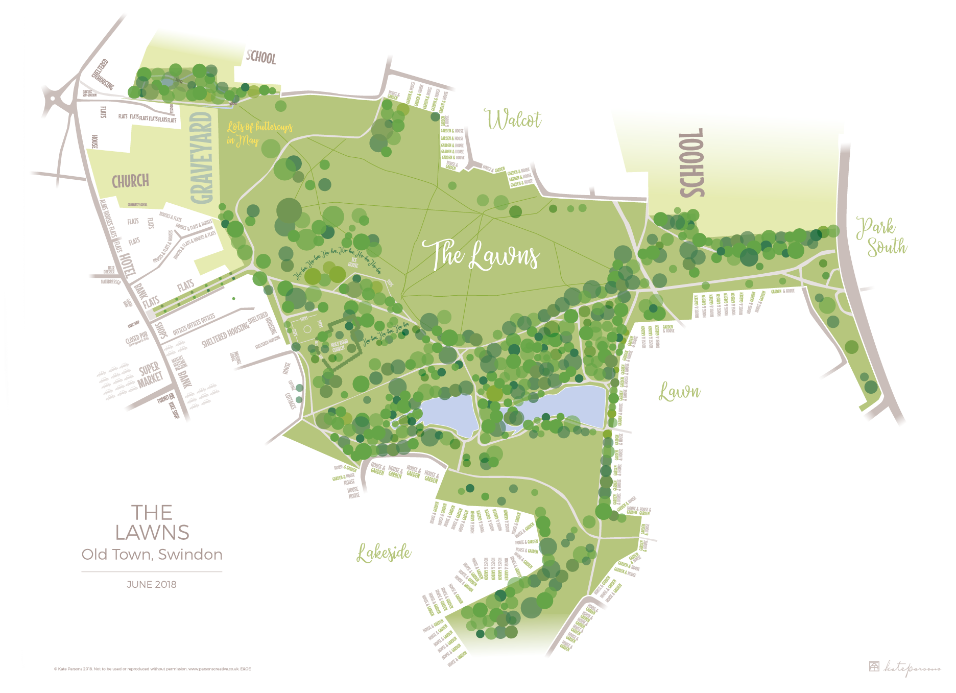
Overview: I like the idea of literally placing information. Maps are a type of infographic, full of information. My urban and park maps use typography to tell you the size of the mapped element, what is and was there. These and other maps are for sale.
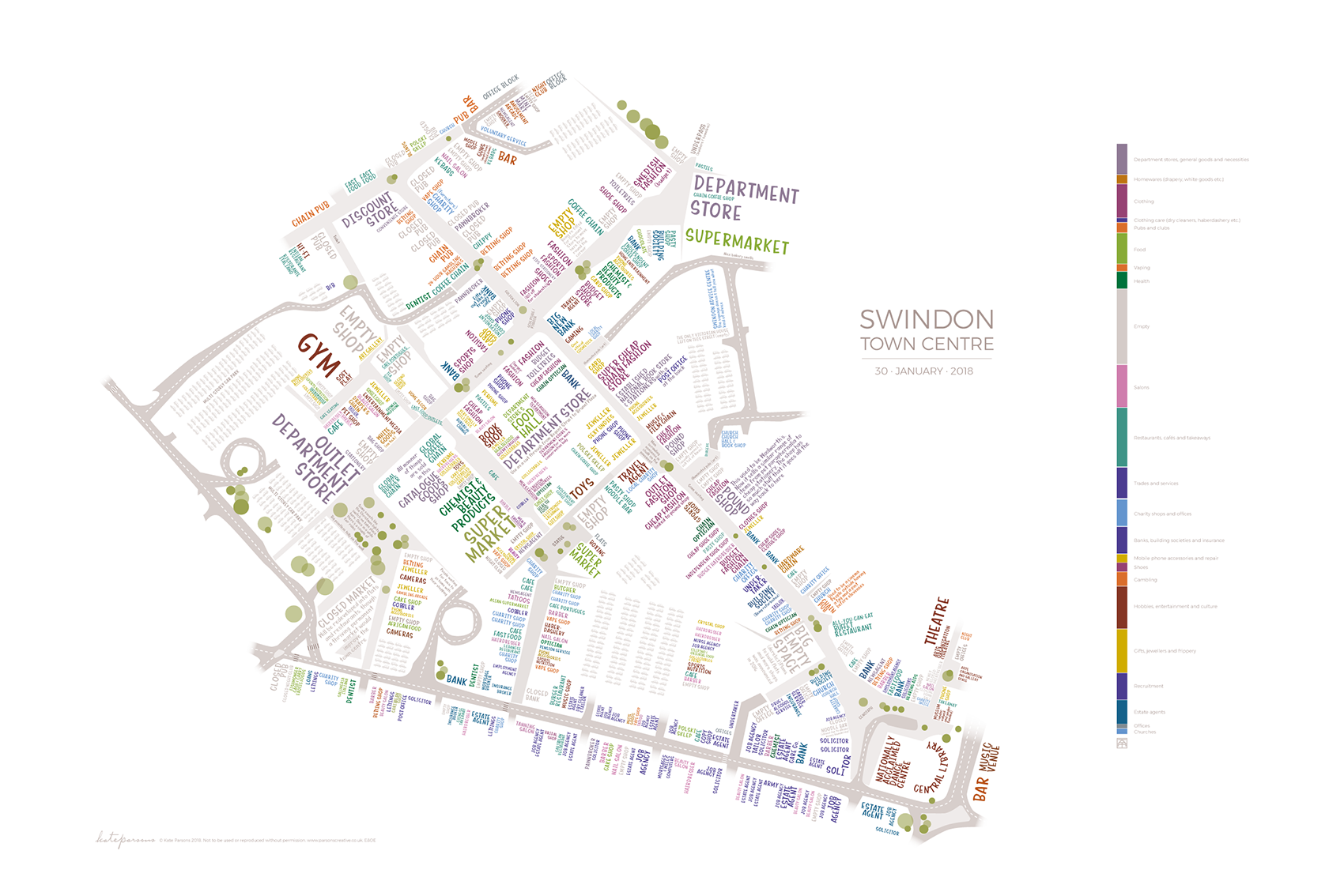
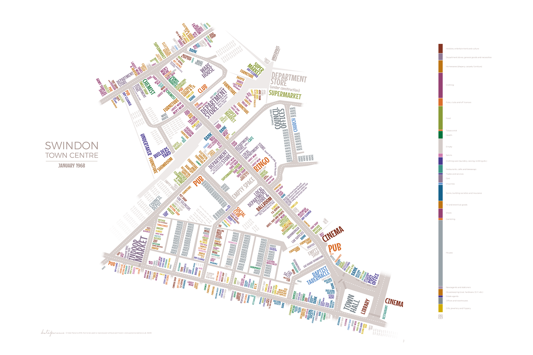
Title: Swindon Town Centre 2018 and 1968.
Overview: Produced to highlight the empty units in today's dwindling town centre in 2018, the 1968 map was later produced as a camparison to show the changes in usage over 50 years. Premises are colour-coded by type of business or activity with prevalence displayed as proportional bar charts. In 1968, a quarter of the town centre was houses; there were lots of ‘home care’ shops, such as DIY, carpets, furniture and drapery – most of these are now on out-of-town retail parks; there were far more shoe shops and ‘clothing care’ shops (dry cleaners, sewing machines, knitting etc), but only one charity shop. Today there are many more 'self-care' premises – hair and beauty salons and tattooists; more empty units; far fewer social premises like pubs, restaurants and social clubs. There is a copy of this map in the Library’s Local Studies department if you’d like to take a closer look. I’ve given a copy to Swindon Alzheimers Society to use at their memory talks.
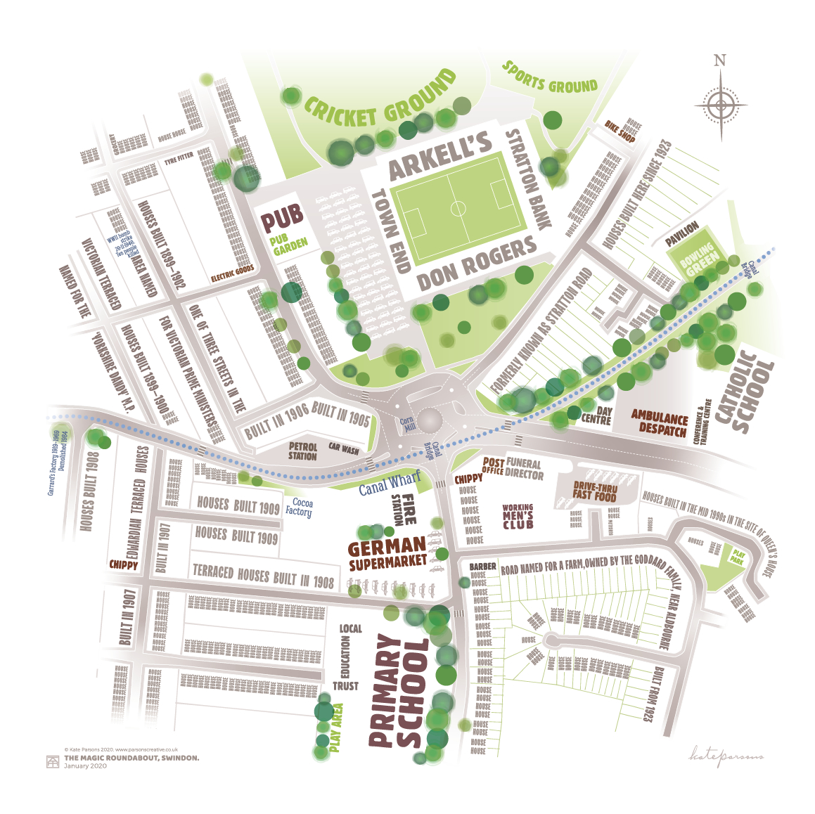
Title: Magic Roundabout
Overview: Perhap's Swindon's most recignisable landmark. The typography describes the location; only The County Ground's stands are named. Places of historic interest, inlcuding the canal route, are overlaid in blue
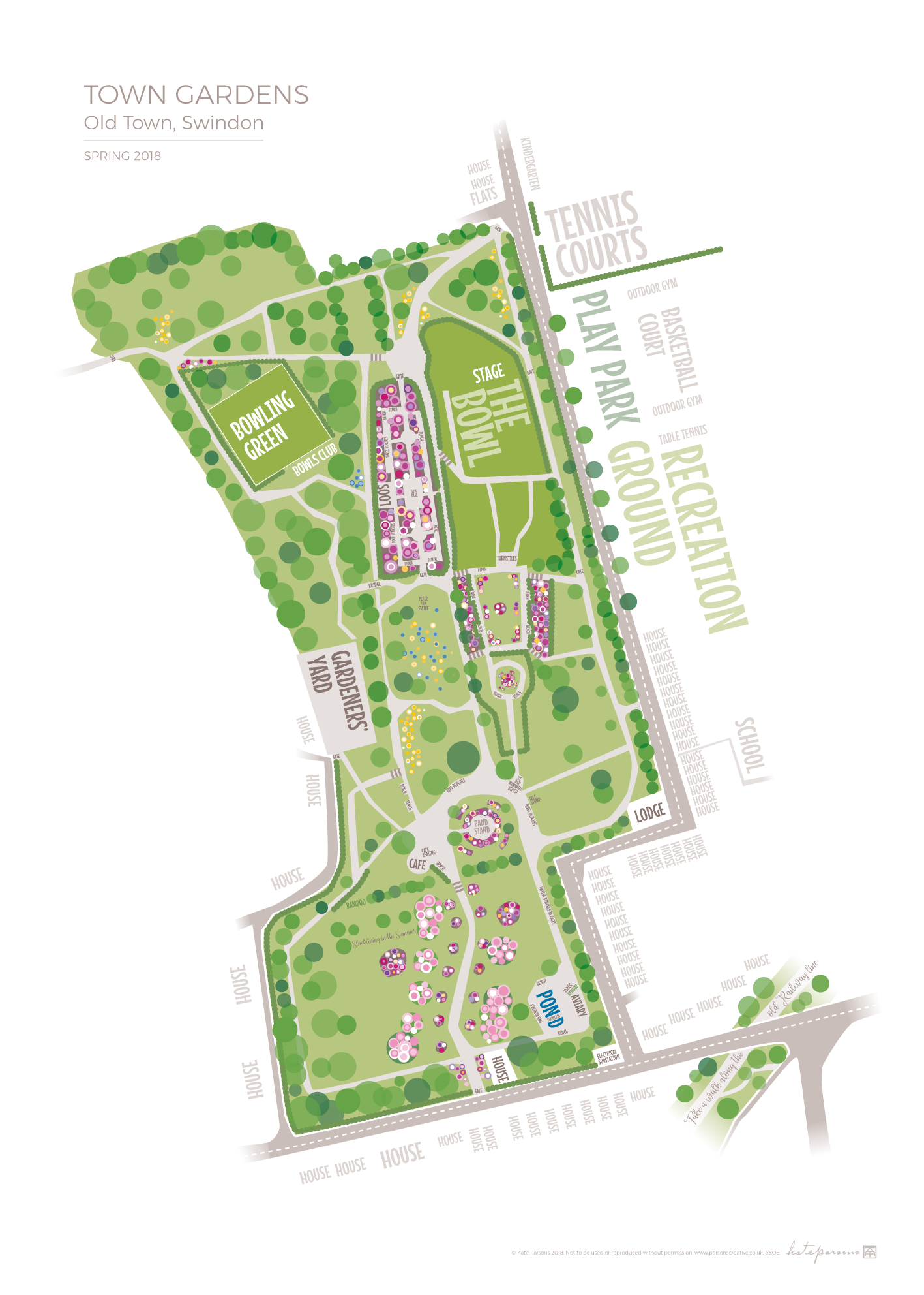
Title: Town Gardens
Overview: Best-selling map; an autumnal version was also created. I spent hours in the park noting the trees and flowers to make this as (unnecessarily) accurate as possible.
Title: The Lawns
Overview: There's almost hidden remains of a church and a ha-ha shown on the map of central Swindon's largest green space.
