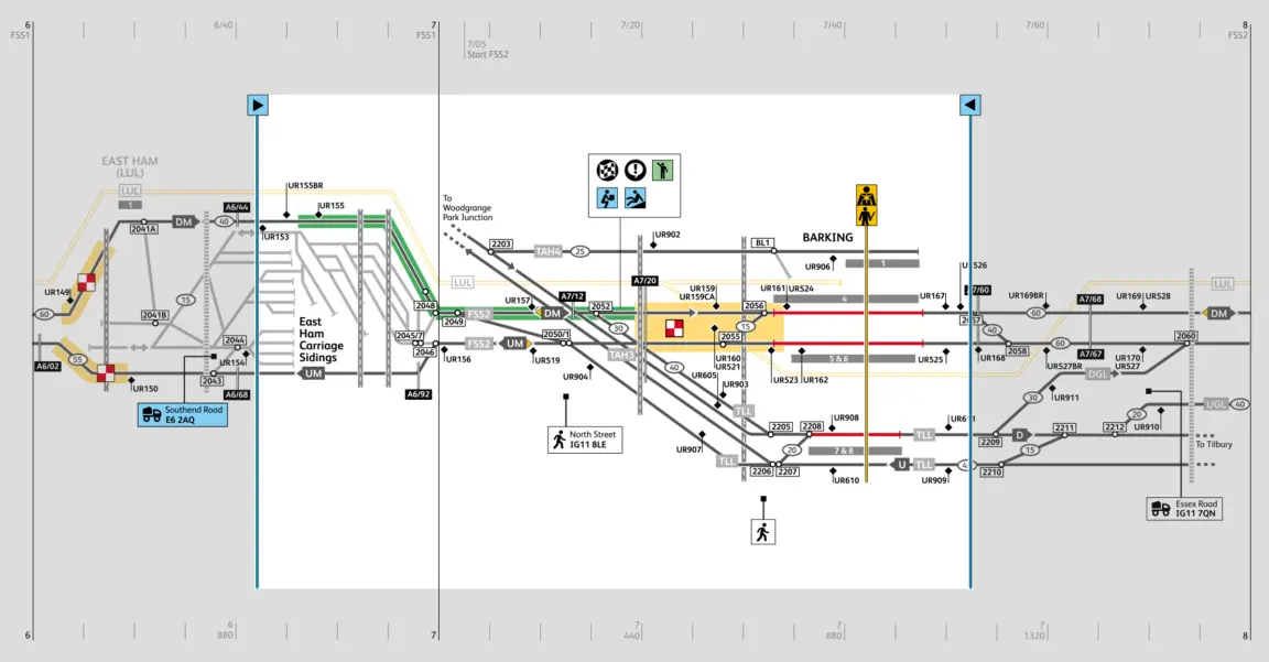
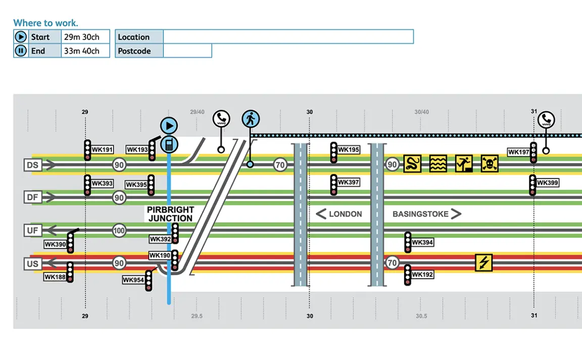
Example of infographic maps, showing work area, signals, hazards and access shown
“Kate proved very able to work with frontline staff, management and risk management consultants to translate findings into a logical flow of clearly presented, pertinent information. She championed the principles of clarity throughout the many stages of the programme's development. Kate's business contacts, ability to sub-contract, manage time and budget enabled trials of the new materials to move easily through iterations.”
Stuart Browning, Network Rail Control of Work Manager
For more than two years I worked as the Visual Communications Lead on Network Rail's multi-million-pound project to improve staff safety protocols. Simplifying reams of paperwork into at-a-glance safety briefings (accessible for lower levels of English comprehension) to create a new safety system for UK rail industry's on-track workers.
I summarised the first four iteration in the project's development, including mapping safety zones, hazard symbols, permit information flow, project process development and physical permit iterations.
I drew miles of maps and consulted with track workers at Barking, Worcester Shrub Hill and other Network Rail depots to get feedback on the visually-led safety system
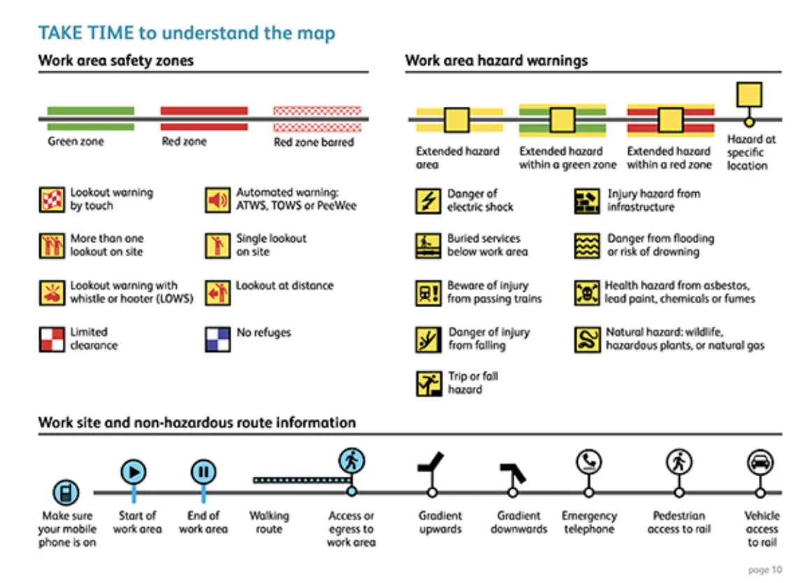
Work safety symbols for the safte sytem of work map key. Lots of interations of colour, symbols' form and risk categories. they
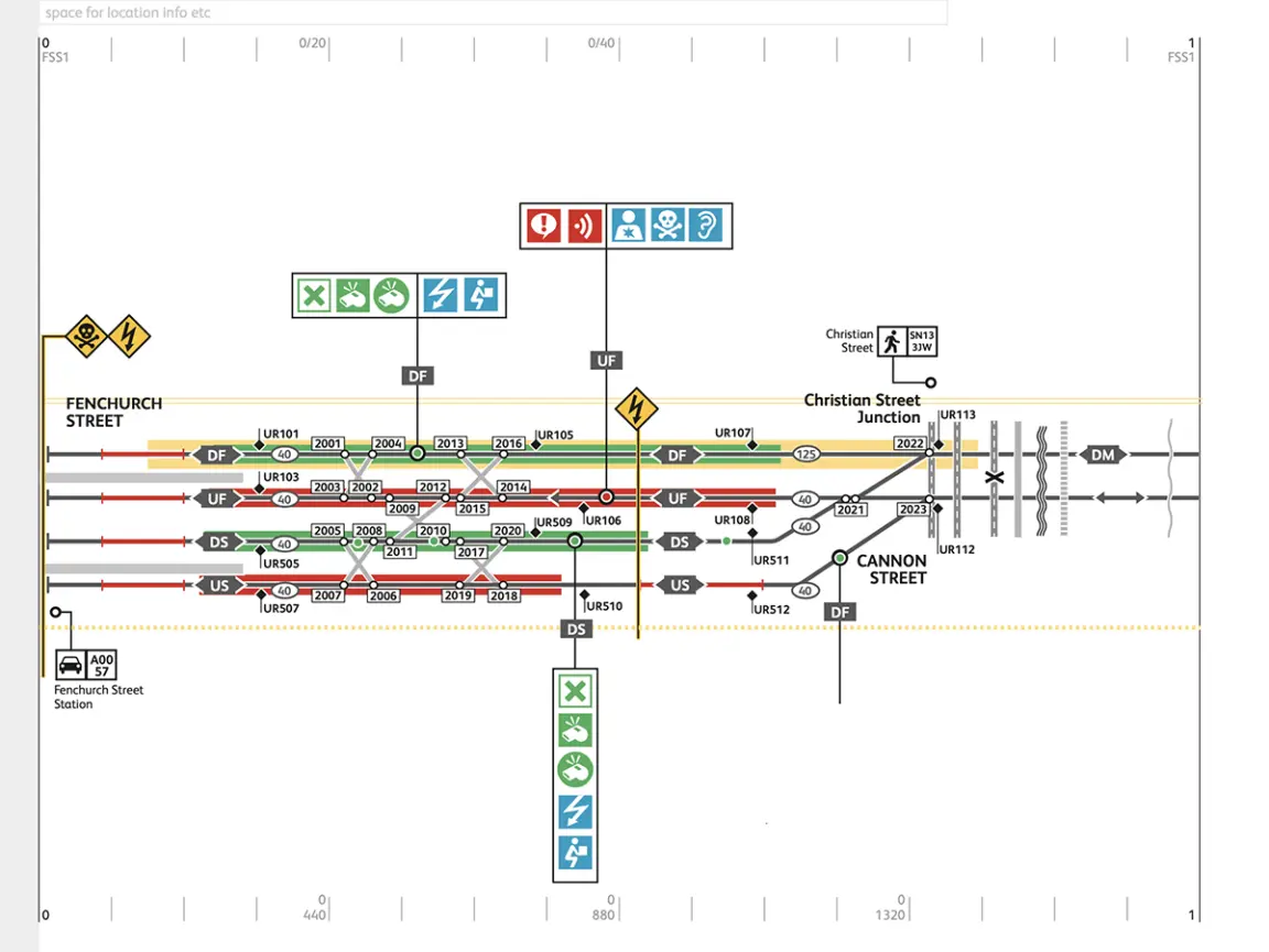
Cannon Street Station track hazards.
This project involved much more than the maps and visual language system shown here. Countless iterations of paper permitting into which countless certifications and procedures fed to create prototypes of paper and digital permit.
Handover report detailing design principles, project scope, issues and challenges and next steps.